
|
|
The Summer of 2019 is currently the most quiet convective-wise Summer which I have experienced in all my years of chasing. The problem is high pressure keeps building which in turn pushes away our low pressure Atlantic driven systems, so in instead of getting our usual Sly and SWly moist unstable flows we have instead been getting cooler and more stable air from the N or NE on a periodic basis. When instability did show up on the models it usually got pushed far S due to the Nly breeze which meant the majority of storms have formed below the border areas into the Republic which would involve a lot of serious driving which couldn't be justified due to a lack of shear and low CAPE. In fact, up until this day we have been getting very low CAPE values from 50 to 100j/kg and often accompanied by positive LIs and capping issues. With that said the country still produced some impressive action in the form of a funnel cloud outbreak throughout the period which was very well documented on camera. During April I chased such a low CAPE set-up to Co. Armagh and time lapsed towers boiling in the afternoon warmth, on the way back I spotted rotation on a cell passing Dungannon, I soon lost it from view due to precipitation then decided to call it a day. Fifteen minutes later I got a call from John Fagan who was chasing the same cell further SW who was better positioned ahead of it and informed me with great excitement that he had just captured a very nice funnel cloud, I missed it, however I was very happy that John got it on camera, this was the first funnel of the season captured from N. Ireland.
The weather was mostly quiet since then however on June 6th the first respectable set-up of the season presented itself on the models. GFS had boasted 600 j/kg of CAPE, LIs - 1 and at last a warm Sly flow. This got my attention immediately and I was already planning to chase this day. There were concerns of course with the forecast, sure why wouldn't there be, it was 2019 after all. There was no speed shear at all which meant storms would be unorganized and of the single cell pulse variety. Further more CIN was showing on the models so there looked to be capping issues and worst of all there was concern about cloud cover which could greatly hinder solar heating, which as we all know, is our primary source of lift. The wind looked straight lined however later in the day when the flow relaxed there could be an outside chance of a funnel cloud, especially in areas with surface convergence. On the morning of the 6th John Fagan and I watched the potential unfold and studied every chart we could find while monitoring radar, sferics and satellite imagery, we knew that despite today's limitations there still was potential for a surprise. What made the forecasting side of things more frustrating was the close proximity of a low to the NW of Ireland which could cover the country with cloud and throw a succession of rain bands over us killing any storm potential. To add to the mix none of the models could agree where storms would form, GFS was keen on messy rain bands wrapping around the low, the AROMA and television forecasts had produced a storm over east Antrim moving N near Ballymena and Larne area, this kept showing again and again on television, it would have been tempting to drive there and wait it out for late storm development however we considered this move foolhardy.
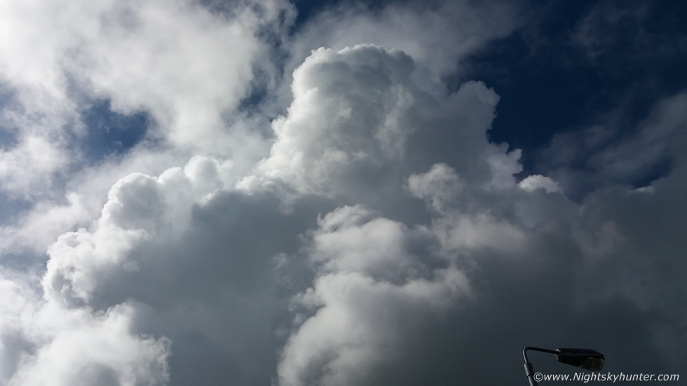
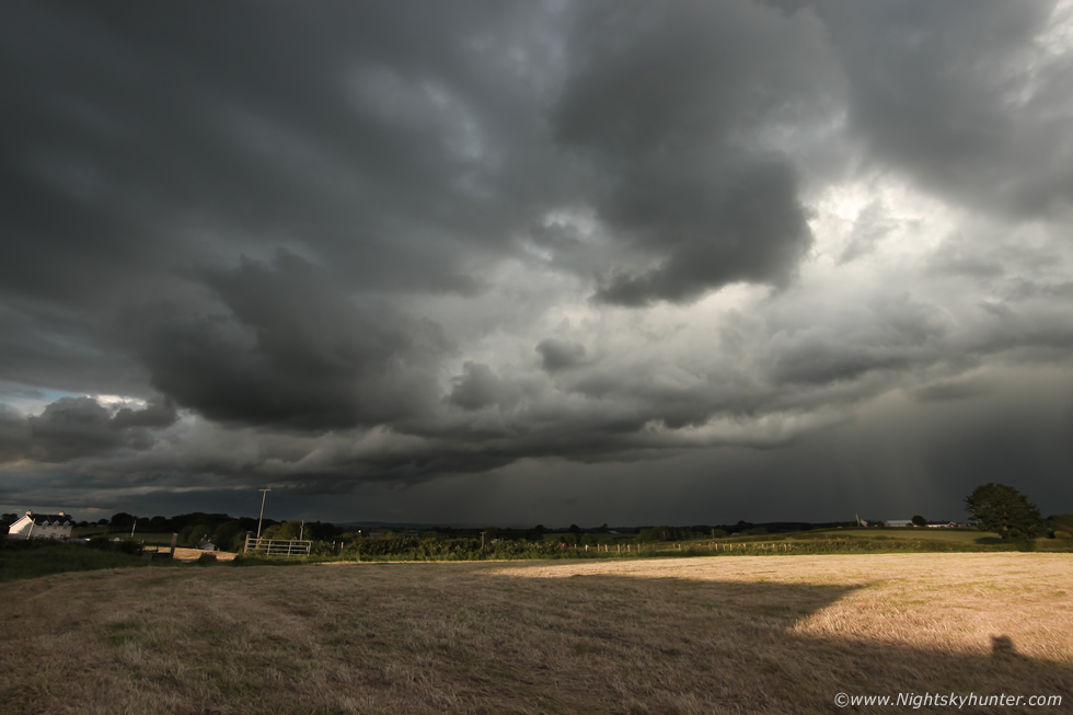
Our combined opinion was we should trust our own instincts and due to the pulse nature of the convection cells could form absolutely anywhere so our policy was to sit tight and monitor radar and wait for developments. By early afternoon the forecast was evolving in line with GFS, a rain band to the N was moving NW, another was approaching from the SW, both of which were wrapping around the low. I was located in dry air between the two bands, it was quite a nice day and sunny breaks were coming through with cumulus med filling the skies, however it was obvious a cap was still at work. By mid afternoon all our eyes were fixated on the southern rain band which was moving north into Co. Tyrone, a cluster of red cores had formed on radar and with little else happening I decided that this was worth a look so I chased to Cookstown and met the band head-on. As soon as I spotted the leading edge while driving along the carriageway I was disappointed and had wished I had never left the house for it was a large mess of rain with no structure at all. I stayed in the area for a while watching the sky, ever the optimist, but I knew I was chasing my tail. I grabbed lunch then drove back to Maghera, in the process I managed to get ahead of the band into clearer skies and it was obvious that solar heating was happening, I passed under numerous towering cumulus bubbling up against the cap and this time they were really trying, I began to get encouraged but I thought the cap would never break.
 |
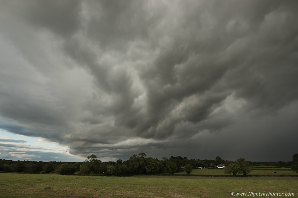
Back in Maghera I considered the day a bust, I relaxed for a while and later had dinner then I happened to walk into the back garden for a look at the sky. I was taken back somewhat by the presence of a huge updraught tower passing by my house, my head was tilted back looking straight up at the zenith, a solid plume could be seen moving with vigor, this was quite a tall tower and the best thing I had seen all day, I contacted the guys and said the sky was talking. I then took a look at the radar and got a delightful shock, a line of red cells had passed between Armagh and Portadown (producing thunder there) and where trekking N/NW over the southern portion of Lough Neagh, they looked good on radar I quickly planned that if I made it to Ballyronan Marina on the NW side of the Lough I should be able to intercept them. With a rush of adrenaline I grabbed my camera gear, drone, a bottle of water, then ran out to the van and drove out on a mad late evening chase, I knew that this could make or break my day and I increased pressure on the accelerator and raced to my target area.
I headed out the Glenshane Road and took the second left exit at Castledawson roundabout in the direction of Toome, a mile or so down this road was a turn off which cut cross country to Ballyronan, I have been using it for years chasing storms there, I was making good time and flowing nicely, my plan was coming together like a well oiled machine. I took the turn off and it was completely different, the old road was gone and like an episode of the twilight zone I entered an unknown road which in turn took me to a small roundabout island but with signs informing me there was only one way I could go so I kept going hoping it would connect up with my old road, it never did. I ended up getting re-routed on a back road which fed into more country roads and to be honest I had never been on them before in my life and I began to get frustrated. The roads were tight, twisting, seemingly going on forever with no open views of the sky but there was no shortage of tall hedges and trees to block my view and not to mention the fact that the nature of these back roads meant I had to slow down which cost me more time. I was heading the general direction I wanted but it was like one of those dreams when everything happens in slow motion and you never get to your destination. I ended up getting held up by slow drivers, cyclists, walkers, then a long flat bed lorry, how it ended up on these narrow roads was beyond me, there was barely enough room for one car, so I was held back yet again, I spent a lot of time huffing and cursing to myself as I drove like a snail behind this lorry for what felt like an eternity, meanwhile the clock was ticking and the storm was changing and I wondered would there been anything left to chase by the time I got free from this maze.
I got past the lorry and onto more twisting country roads, this time I could see my target cells ahead of me, they were moving fast and closer than I had anticipated. As long as I had them in sight and kept driving E/SE I would be on target. I took more tight bends, passing trees and abandoned old houses (quite scenic actually and classic old Irish style) then after more cursing I got on a better road. I was now flanking the lough and somewhere N of Ballyronan, I just needed an open space between the trees for a decent place to get images. I took the first road on the left I saw and raced down it, I had never been on this one in my life before either, it came to a dead end at the bottom. From there it looked like a public walk or trail cut through a forest beside the lough, I could see the water through the branches and I began to get excited. I grabbed my camera bag and tripod and jogged along the trail expecting an opening at any minute. I found none, I ran further and now the van was far away, all I could see were trees, I had no view of the sky at all. I turned around and ran back to the van, my heart was thumping in my chest and I was getting out of breath carrying the gear and running and now dehydrated, at this point I almost gave up on the chase, nothing seemed to be going rite since that change of road on the new by-pass. I got back in the van, took a drink of water, collected myself, calmed my head and gave it one last chance, I wasn't going to give up yet.
 |
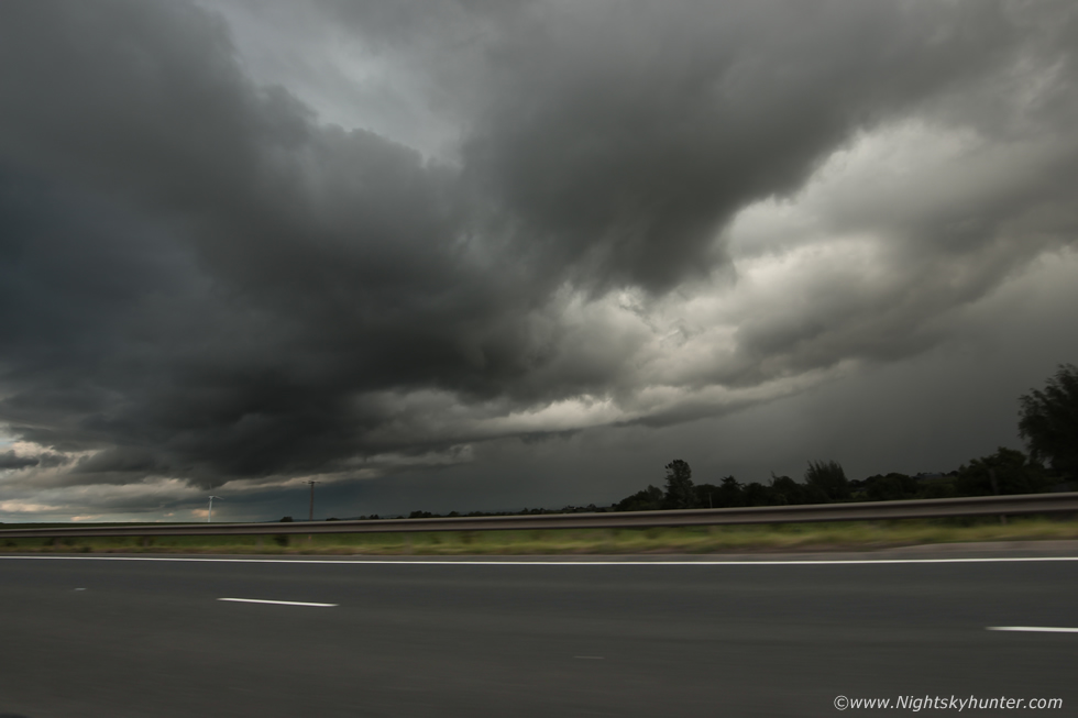
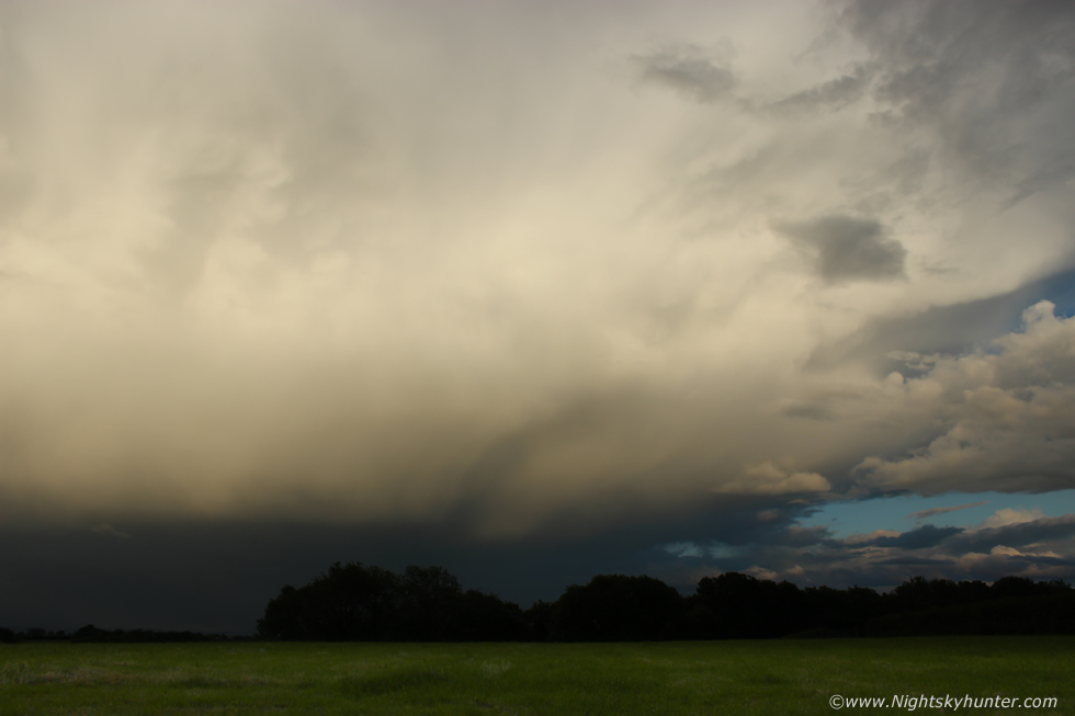
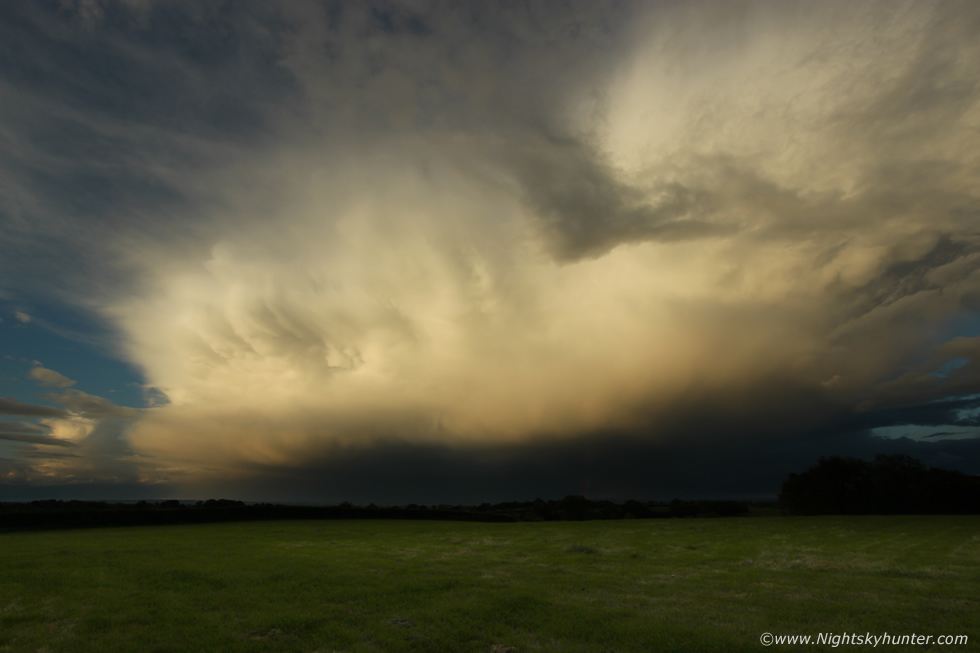
I re-traced my steps and got back on the main road, on my left Gracelands flashed past me then I arrived at Ballyronan Marina, however because of my delay the target area had changed. The precip core of the cell was over the lough however the meaty gust front area was now over land moving more NW. I continued for a few more miles down the lough then pulled over onto the grass for a look, got out, and took my first images from this chase. What was once tight solid structure was now loosening as the cell became outflow dominant with a gust front surging out towards land, here's the view at 10mm.
 |
I didn't want to end up in the core and loose sight of it so I turned around and drove back the way I came for a few miles with the cell chasing my tail, I got far enough ahead to clear the core and pulled over for another look. This was once again under the gust front, moving L to R, there was actually persistent rotation and rising motion going on between the gust front and core which held my attention for a while, then the first heavy rain drops splashed on the windscreen and the core had caught up with me again. Once more I was back on the road, my plan was simple, stay ahead of it in the dry air for structure.
 |
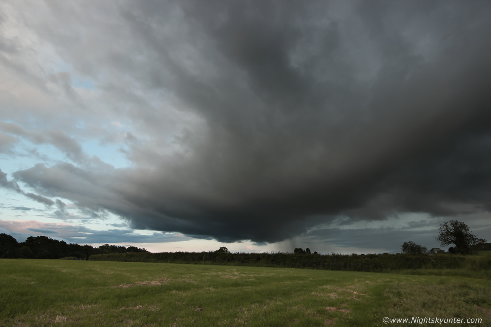
This time I raced N and W to get ahead of it which took some doing as the cell was really moving along fast. Not so long ago it looked weak but now it seemed to be gaining strength, I entered another world of crazy country roads, tight and twisting but my direction and instincts were good and I was making positive progress. I stopped on the side of a road and leaned over a gate for more images, entire E side of gust front on view with whale's mouth, moving R to L and at 10mm wide angle, it was on me in no time and once again I was racing along back roads trying to outrun this cell.
 |
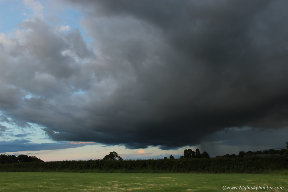
The outflow clouds were moving at an impressive speed, this was from the by-pass outside Magherafelt, I was doing 60mph and the cell was still on me. It was getting late in the evening now and I wondered if any last minute photo opportunities could be had, I was committed now and I was in the zone, it was just me and the cell.
 |
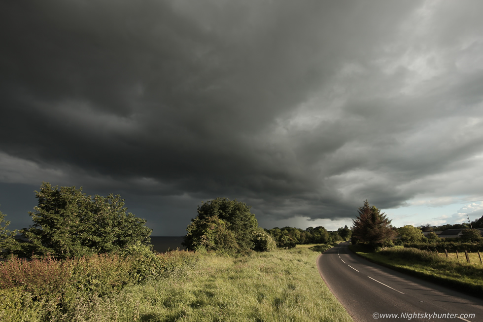
The storm complex was getting larger and more impressive from the glimpses I got of it in my rear view mirror, the cell seemed to be chasing me back home, I was still ahead of it and decided it was worthy of more images. I took a small roundabout and arrived in Gulladuff, I took a minor road and pulled over adjacent to a huge field. The gate was open and the field had been freshly cut, it was perfect, I like flat open spaces for storms and the warm evening sunshine was casting long shadows across the grass, this moment had already made my day. This is the mid section and flank of the cell with segment of bow with piercing anti-crepuscular rays, the edge of the anvil can be seen in the clearance, I had the 10mm Samyang on.
 |
Panning 90 degrees to my left to take in the gust front region, I have to say this scene looked rather decent and I was beginning to feel more relaxed and happy with the way this chase was going. Strong curtains of precip were falling so there must have been new towers forming ahead of the older cell, the outflow from the original cell had acted like a cold front scooping up the warmer air as a form of lift and aiding with new updraught formation, I can tell you I felt glad to be shooting storm clouds once again, it had felt like a long time since I had a local chase like this.
 |
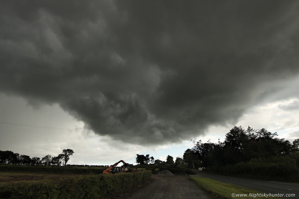
Gust front closer now filling in the sky, you can see the mid level clouds to the upper left streaming away from the cell due to the outflow winds. For me in this field it was a different story, I was warm, the sun was on my face and I will admit it, I felt happy. There was a bungalow on the other side of the road behind me and I was aware of eyes watching, wondering who this intruder was standing in their field with a camera. I had got what I needed then continued along the road getting closer to the cell, by complete chance I was heading back to my home town of Maghera.
 |
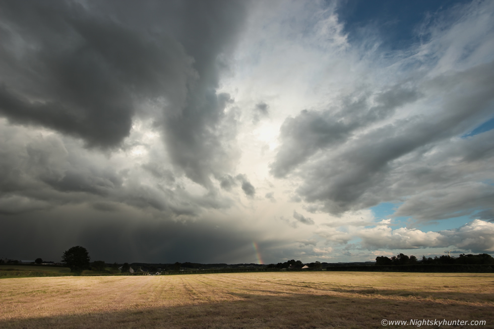
Suddenly I glimpsed those new towers on the leading edge and I immediately knew I was experiencing the best sight of the day, I cut through Maghera into the country roads which I know exceedingly well then parked at an old storm spotting location. I grabbed the gear, went over a fence, and into another large field where I had a great view of the sky and could be at peace. The cell looked huge and dominated the E to NE sky sectors and lit brilliant white by the low evening sun, this was a photogenic moment which had to be captured so I got the camera bag opened within seconds. Cell motion was now slow and more photo friendly, moving R to L and away from the camera.
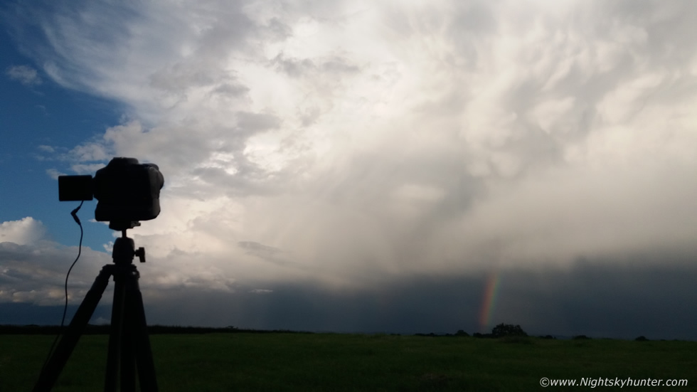 |
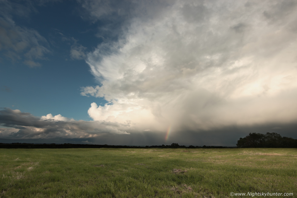
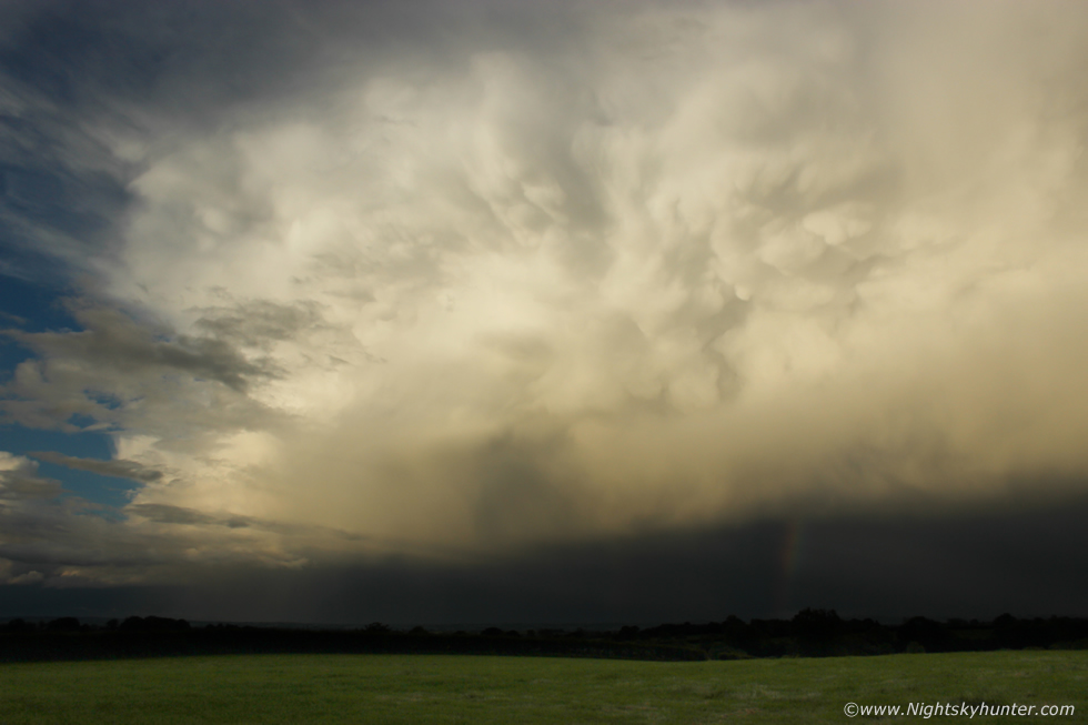
I set up the DSLR with 10mm lens and shot a long time lapse sequence, I was now in my element, this was almost like a scene from the USA. Perfect light, perfect uninterrupted view and complimented by a cluster of mammatus and rainbow. The camera's shutter clicked once every second, this was taken with my phone.
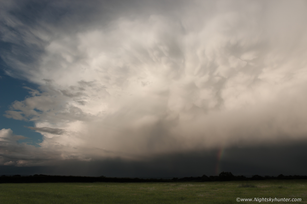 |
Time seemed to slow down and this cell just sat there showing off for what seemed like forever, perfect time lapse material, I couldn't believe my luck. After the first sequence was shot I switched to an 18mm lens and began a second time lapse. That was a solid looking cell, I was quite impressed given the set-up, just goes to show that even on days of no shear and with capping issues unexpected wonders can happen.
 |
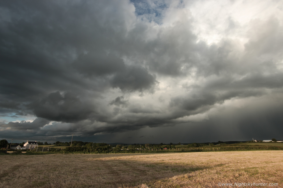
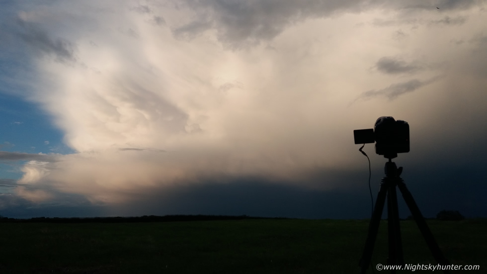
As the camera took stills for a time lapse movie I returned to the van and retrieved my back up DSLR so this way I could take stills at my leisure while the other camera shot time-lapse, it really was the ideal scenario. This was the far right hand side of the cell, it was already 21.00 in the evening, it felt like many people were inside watching television oblivious to this dramatic sky.
 |
This was a keeper and well worth all the forecasting and driving frustrations earlier. This is what I love about storm chasing, you end up on roads and parts of the country you have never been before, you become intimate with the atmosphere and you never know what you are going to see, this day was a testament to that.
It was 21.25 BST and approaching the last light of day, I set up for another time lapse sequence with the trusty 10mm back in business, I shot some vlog scenes with the phone too.
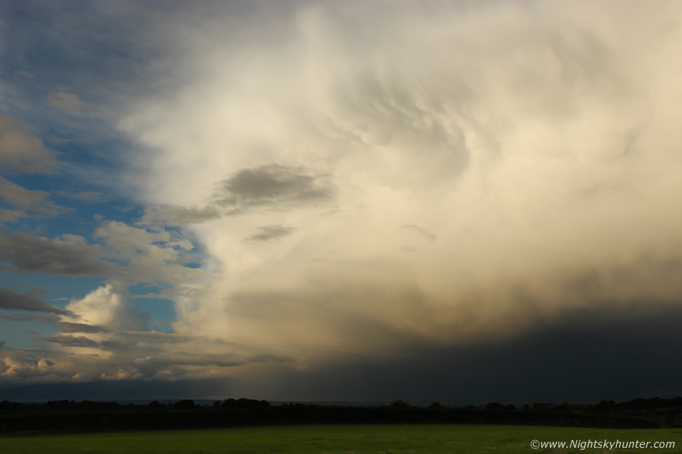 |
With the back-up camera I took more stills, this was 18mm. Behind me I spotted a new cell to the S, I could see tall towers marking the main updraught and the towers were leaning over which was strange as there was no shear, it looked to be heading my way soon too.
 |
10mm of the cell at sunset, you can appreciate its size in this wide angle image and at this moment it was already a fair distance away to the NE. I quickly stopped the time lapse and turned around to face S for the next cell.
 |
This was a most unusual cell, the updraught base was tall but narrow and looked to be tilted from the growing precip core. It looked more like LP structure than a conventional single cell, there was no rotation at all of course however it was tidy looking and worthy of one last time lapse. 10mm, one image per second, shooting. I liked the low clouds streaming away from the base radiating outward, it seemed to be using up the very last of the day's CAPE.
 |
18mm, the time lapse actually turned out great from both cells so I was well pleased. I kept shooting this one until the core arrived soaking the camera then I grabbed the gear and got back in the van for shelter when a torrential downpour ensued. When I got back home it was 22.00 BST, I can tell you that after such a poor storm drought this season these clouds took the edge of my hunger, but only just, in truth they have wetted my appetite for more.
On June 6th I made a blunder I regretted. That evening I was walking along a beach on the shore of Lough Foyle with my Mother and our dog Rhua, I had noticed the presence of capped towering cumulus in the area, the tops were flattening out but the bases were compact, dark and well defined, I thought to myself there could be funnels today, however I never took the thought that seriously. After 19.00 I was on the beach looking at the sand when I happened to look to my right, there was a fully mature funnel cloud rotating over Lough Foyle close to the south shore, I was flabbergasted and couldn't believe it. The funnel was black, very well defined with sharp edges like an inverted cone and tapered to a point over half way to the surface of the lough. I could actually see it rotating and I got the impression that the vortex was being stretched vertically from the water to the funnel, the surface was blocked by a pier so I considered the possibility of it being a waterspout. I had no camera on me, the DSLR and 100-400mm lens was back in the van and too far away, I knew I would never make it on time and sure enough it vanished within 1.5 minutes. I was so annoyed I didn't trust my instincts as I would be sharing a beautiful funnel cloud image on here now, but at least I saw it, this was my first funnel sighting of the 2019 season.
The funnel had formed under the base of a towering cumulus from a convergence zone, or more specifically sea breeze convergence. I could see clouds approaching from the SW yet other clouds moved in from the N and they merged together to form a line of showers over the lough. The lesson from this day was to never doubt your instincts and experience, if there's a remote chance at all then grab your camera, I didn't listen and paid the price and I should have known better, I wont make that mistake again.
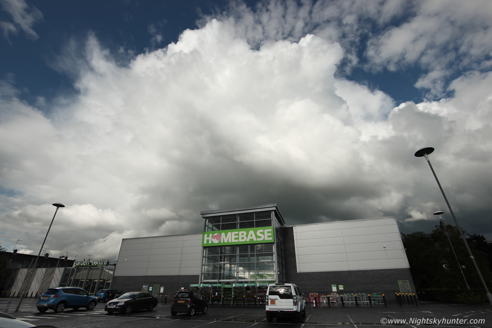 |
June 8th, a day of low CAPE and very high wind shear, in fact, convective maps were showing more than 30 knots of speed shear with good moisture and low cloud bases, in theory tornadoes would have been possible in such a scenario. Big showers broke out during the late afternoon, I have never seen such hungry convection before, despite being low topped the cells were feeding from the rich low moisture, I routinely saw scud being sucked upwards into the main updraft, it was quite dramatic. A thunderstorm formed over the Sperrins however I had just arrived in Cookstown to meet Roisin. A downpour hammered the area for a very long time, once it moved E I could see the rear of the cell over Homebase, much to my delight I watched the cell back-build with continuous updraught formation, even though the cell was moving further away the constant towers gave the impression it was barely moving at all, in other words it was training. I took this 10mm shot of the scene and actually shot an 11 second time lapse from the car park grounds, and yes I did get strange looks from some of the shoppers leaving Homebase.
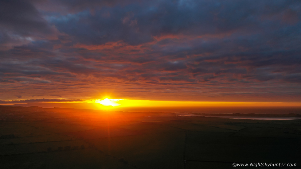 |
June 11th and once again at the north coast where I was doing a late evening drone flight. I had pulled into a picnic area to eat a sandwich before going home, the sky was covered in mid level cloud when suddenly the entire complex became under-lit by the setting sun. It was an astonishing sight, trees around me were cast in surreal red light while the cloud deck was lit orange then red with nice complex structure, the sunset show lasted for quite some time and was for me the best sunset of the year. I launched the Mavic 2 Pro and shot a few stills and video sequences, I couldn't have asked for a better end to the day.
Video footage of the June 6th storm chase featuring Go Pro footage of the an aspect of my country road chasing then climaxing with the evening cell time lapse shoot from Maghera.
Drone footage of the June 11th spectacular sunset at the coast, it felt more like Autumn this day with the wind gusting to 24mph however the sky wanted to be Summer and that surreal sunset light made me forget about any chill I felt. This report sums up my convective adventures thus far this season, the trend for June isn't inspiring at the current time of writing with no hot weather or big storm set-ups, however all it takes is a change in the charts because one day can make an entire season, until then, thanks very much for reading.
Martin McKenna